

Artificial satellites launched from all over the world are in orbit around the earth, and the satellite tracker service “Celes TrakAccording to data from “, as of September 6, 2024, there are 10,345 active satellites alone. A 3D visualization of the classification, current position, orbit, etc. of a large number of satellites.Keep trackIn addition to visually understanding how many satellites there are, you can also check where the satellite you are looking at is currently located and how it is moving.
Keep Track – 3D Satellite Toolkit
https://app.keeptrack.space/
KeepTrack – Home
https://keeptrack.space/
Keep Track can be accessed for free from your browser. When I opened Keep Track, there was a few seconds of loading time.

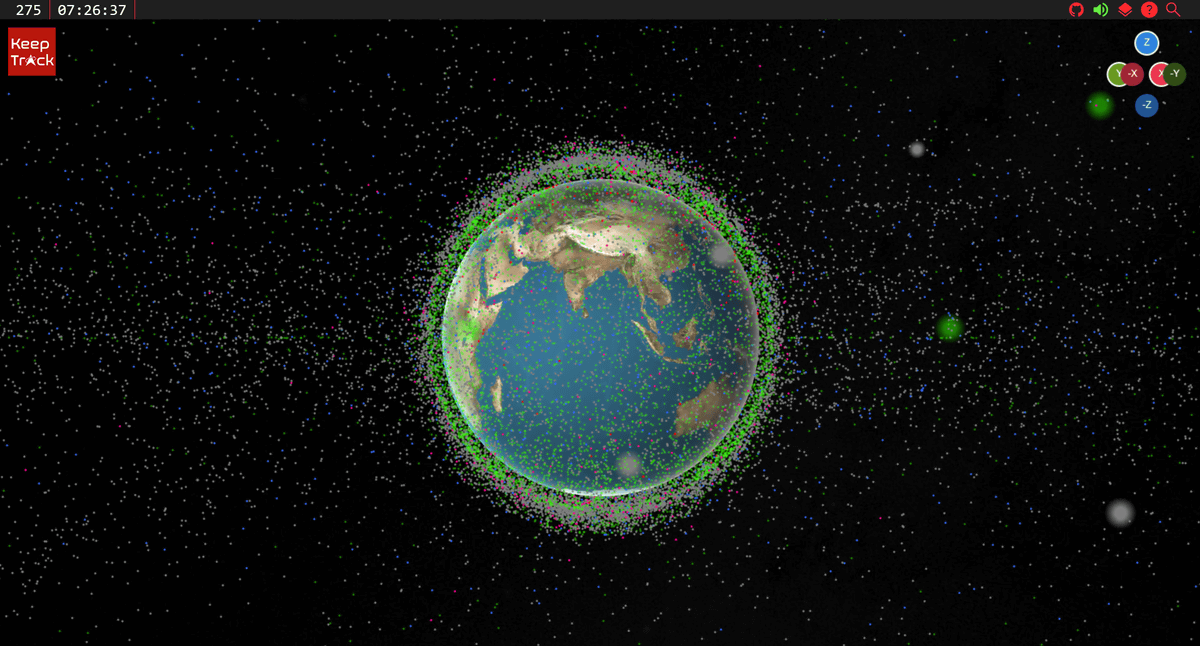
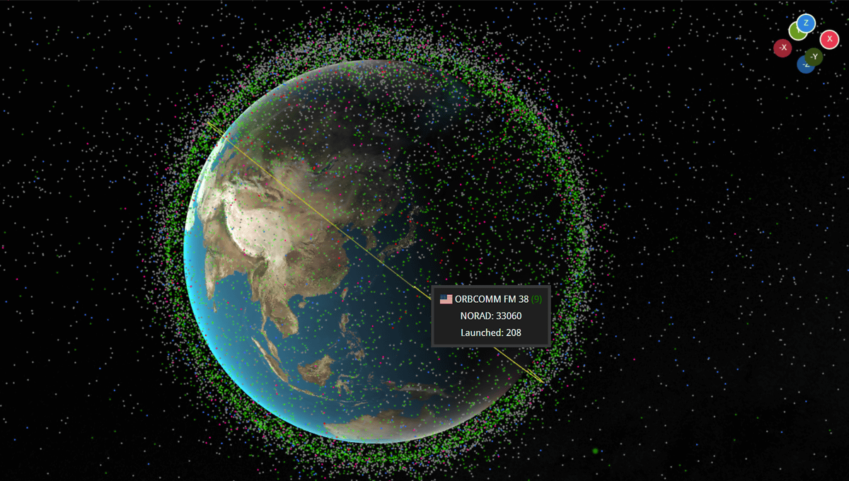
Below is the Keep Track screen. Countless dots around the Earth indicate more than 37,000 artificial satellites, both active and inactive.
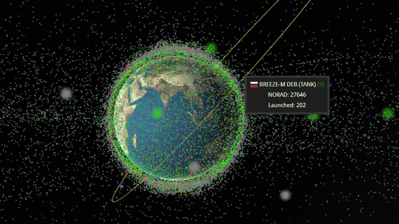
When you hover your mouse over a point, it will show you what kind of satellite each point is.
You can zoom out or zoom in by scrolling. If you zoom out, you can clearly see that the satellite network extends far from the Earth.
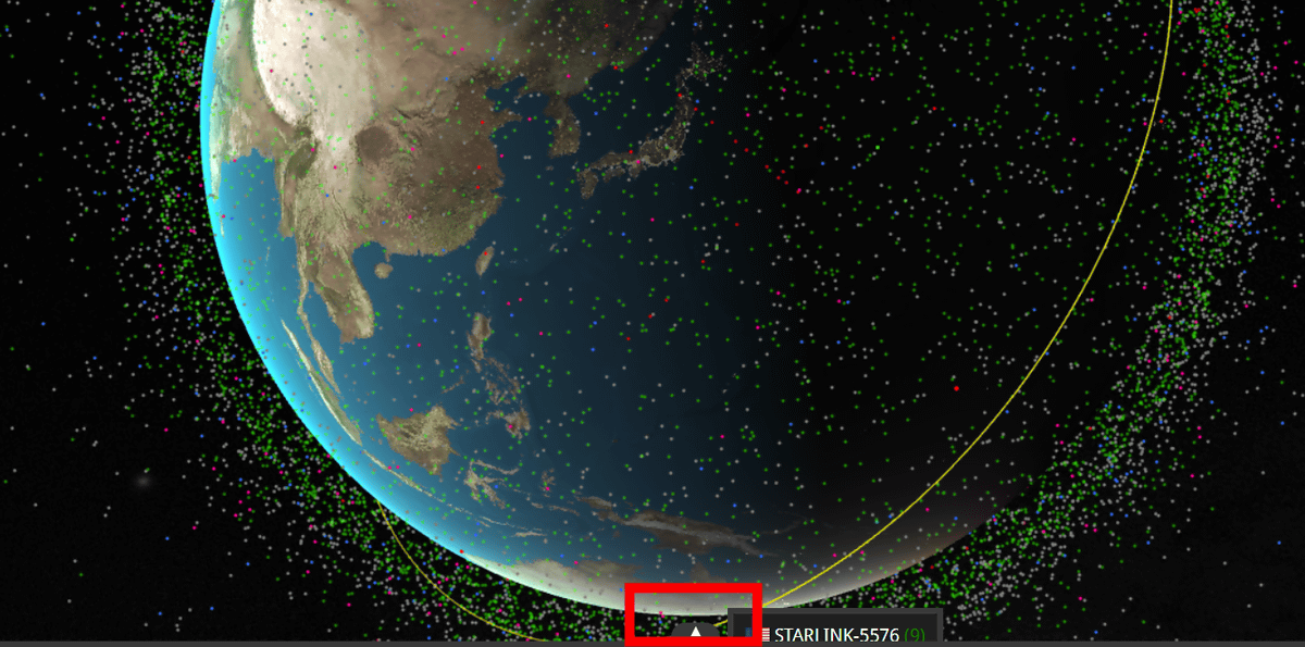
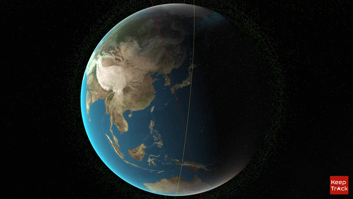
You can also rotate the earth by dragging the mouse or moving the X/Y/Z axis icons in the upper right corner. When I tried looking at Japan, it was around 5pm at the time of writing the article, so the sun was setting and there was a faint shadow. In this way, Keep Track allows you to check where and what kind of satellites are flying on the earth in real time.
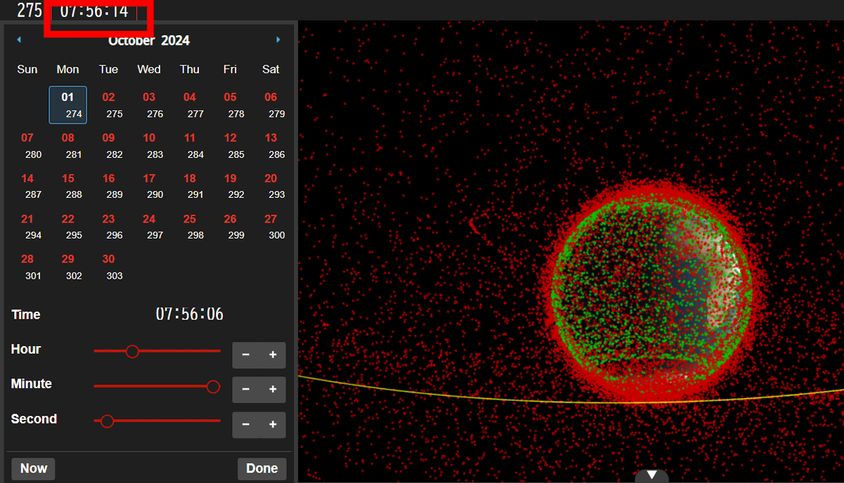
The time is displayed in world standard time in the upper left, but by clicking on this time, you can go back to any date and time and see “How was the satellite flying at this time on this day?”
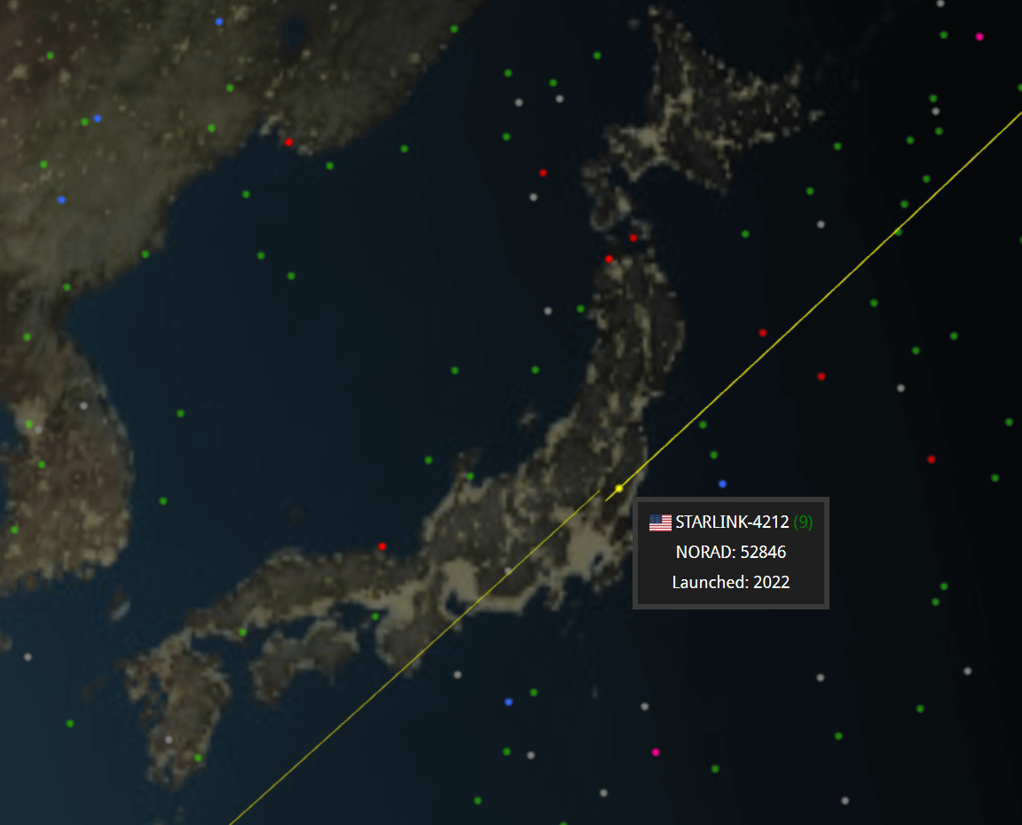
Expanding further, I investigated the artificial satellites in the sky above Japan at the time of writing the article. SpaceX’s satellite internet “Starlink” model number 4212 was flying over the Kanto region.
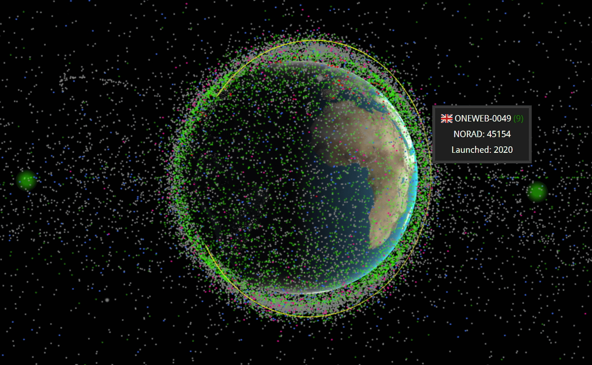
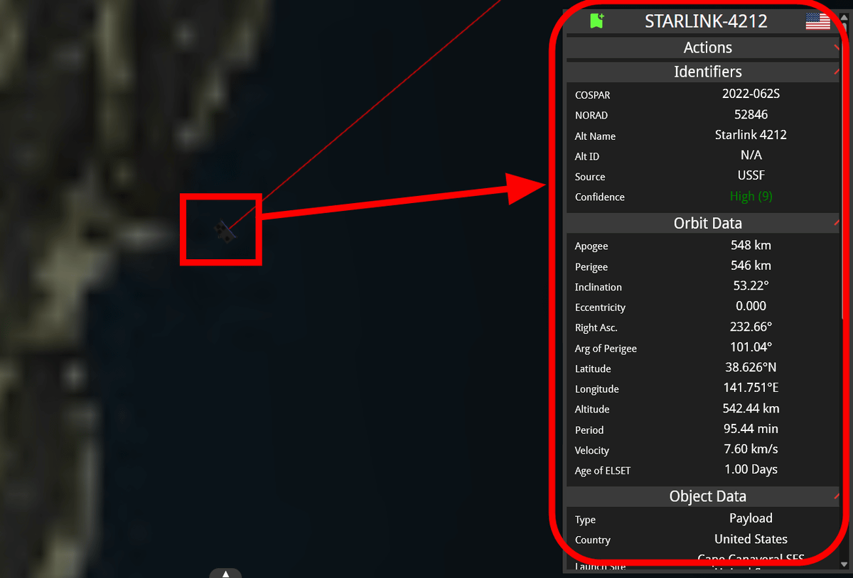
Click on a satellite to check more detailed information.
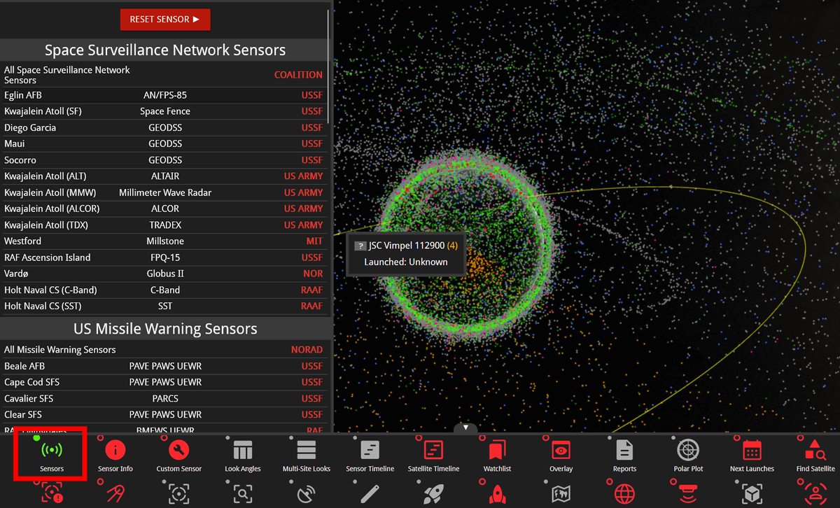
Click the triangle icon at the bottom of the Keep Track screen to display a more detailed menu.
By clicking “Sensors”, you can narrow down the satellites by facility or organization managing the satellite.
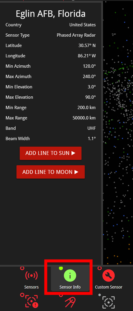
From “Sensor Info”, you can view the details of the narrowed-down facilities and organizations. The image below is located in Florida.Eglin Air Force BaseI opened the details.
By clicking “Take Photo” with any artificial satellite selected, you can download an image of the selected artificial satellite moving in Earth orbit.
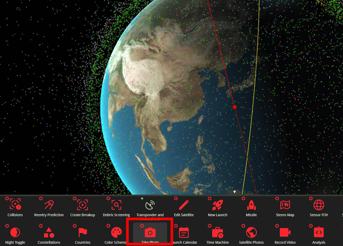
The downloaded image is below. Only the selected satellite is displayed, making it cleaner and easier to see.
From “Find Satellite”, you can narrow down the search for any artificial satellite. From the search window on the left, change “County” to “Japan”.
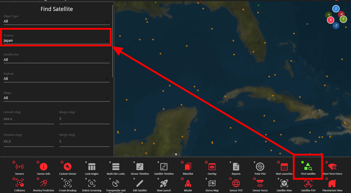
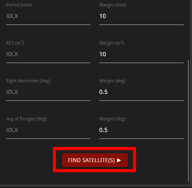
Click “FIND SATTELLITE(S)”.
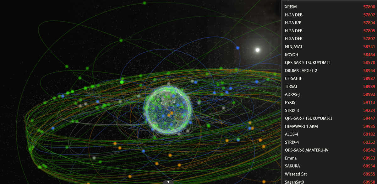
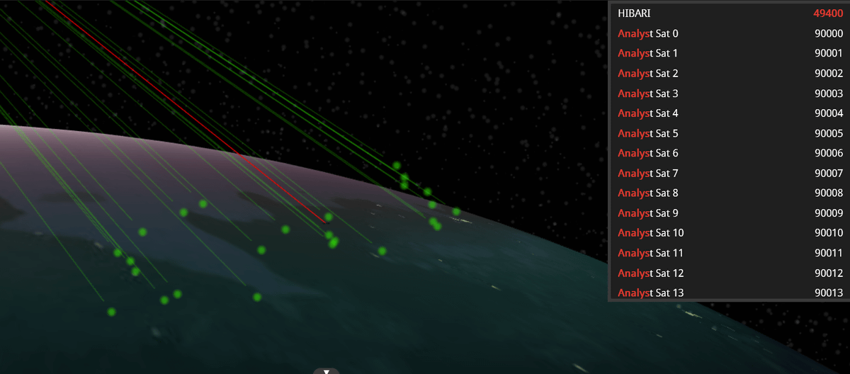
Only Japanese satellites were lined up in Earth orbit, and a list of names was displayed on the right side.
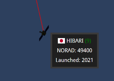
Among Japan’s artificial satellites, the microsatellite launched by Tokyo Institute of Technology in 2021.lark” was discovered. If you zoom to the maximum, you can also see the approximate shape of the satellite.
You can also change the color of a specific satellite. SpaceX’s satellite internet “Starlink” has launched numerous orbits to expand and strengthen its services, and CEO Elon Musk said on September 6, 2024, “AllStarlink satellites account for about two-thirds of active satellites” announced. So, let’s check how many Starlink satellites there are actually by color-coding. Click “Starlink” from “Color Schemes” in the menu.
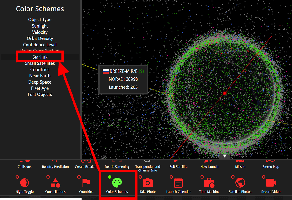
In the image below, green is Starlink and red is other artificial satellites. There are only other artificial satellites in red that are far away from the earth, but you can see that Starlink, shown in green, is flying close to the earth so that it covers the surface of the earth.
Furthermore, a major feature of Keep Track is that it includes a “satellite destruction simulation.” Select any satellite, select “Create Breakup” from the menu, and click “CREATE BREAKUP” in the window displayed on the left.
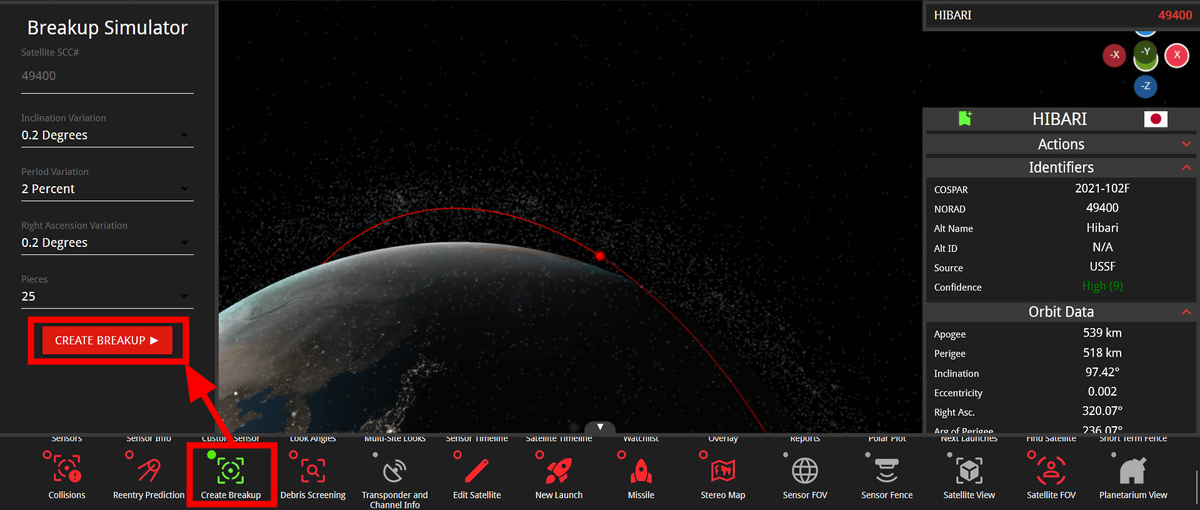
Then, you can see a simulation of how the selected satellite will break down into the specified number of pieces and move in orbit after that. Keep Track’s mission is to map the orbits of artificial satellites, which can be used as a reference for new launches, and also to solve the space debris problem of used satellites.
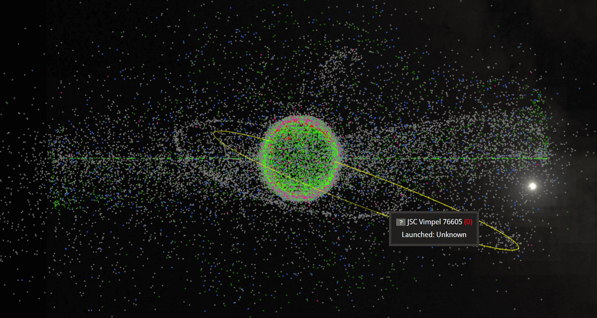
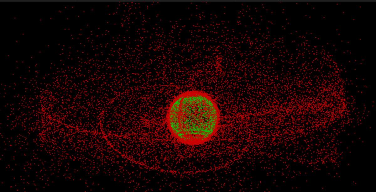
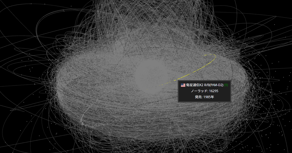
From the official page, you can also see the state of space debris in Earth’s orbit. The image below is an example of this, and you can clearly see that it is overflowing with countless debris to the point that the Earth can no longer be seen from the line indicating the orbit.
Keep Track is open source software and details are available on GitHub.

Copy the title and URL of this article